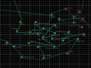
Official Volition Node Map
Volition released this map in 1998 as the standard reference for all jump nodes in the FreeSpace Universe. While FS2 adheres to this map for the most part, there are unfortunately numerous conflicts between what is seen here, and what is seen in both games. See Node Inconsistencies for a list of these conflicts.
The systems on this map do not adhere with the stars' positions as seen in the night sky from Earth, nor the relative distances to one another (for those that exist in real life).
Although some systems in the upper right-hand corner of the map are coloured red, the coloration does not appear to indicate possession by hostile powers, as the supposed takeover of nearly all the affected systems does not correspond to any particular period in FreeSpace history.
Contents
User-made Node Maps
Several user-made node maps are available. Some of them are simple recreations of the canon node map, while others add non-canon systems to the compendium.
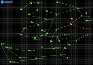
BWO Node Map

In 2006, the Blackwater Operations team released a non-canon nodemap that can be used as a fairly consistent map of the location of non-canon systems such as Tania Australis and Tau Sigma within the Cold Element continuity.
CP5670's Starmap
CP5670's node map was based on the official node map, but corrects some of the latter's errors and incorporates the changes made in FS2. It can be found here.
Galemp's Bubble Grid Node Maps
Galemp created several "bubble grid" node maps, each corresponding to numerous periods in FreeSpace history, which aimed to be easily readable.
MjnMixael's High-Resolution Node Maps
MjnMixael's high-resolution version of the official FS1 node map is available here; its FS2-derived counterpart is available here. Both aim to be as faithful to the official node map as possible while producing more readable, higher-resolution images.


